You are currently browsing the monthly archive for December 2013.
Today, you can walk along a ribbon of green space bordering the Regent Canal from Limehouse through the Mile End Park and on to Victoria Park in Hackney areas once considered as sites for the park. In the early C19th health campaigners were concerned that the poor in the East End of London had no access to open parkland. A petition supporting Metropolitan improvement in the form a park in 1840 was signed by 30,000 people. In 1842 The Victoria Park Bill was passed unopposed, there were two sites up for consideration: Lime House to Mile End in the South and East of Bethnal Green in the north. The northern site was chosen because it was the cheaper option.
Along the bank of the canal there are still some C19th warehouses interspersed with new development. One warehouse contains the Ragged School Museum which opens Tuesdays and Wednesdays. By luck, the manager spotted me taking photographs and invited me in to look round even though it was not an open day. It opened as a school in 1876 by Thomas Barnardo who gave up his medical training to open a free school for the poor. Once an area for the poor of London but now an area for speculative property developers and foreign buyers. The flat pack waterside apartments with the obligatory bright colour flash litter the banks of the canal.
A green bridge spans the north and south section of Mile End Park allowing you to continue walking in parkland whilst crossing the busy Mile End Road.
The spire of the Victorian Gothic Guardian Angels church remains the imposing landmark in this area. Arts and Ecology Pavillions overlook a small lake which is close to the former site of the New Globe Pleasure Gardens 1840.
At the point where the Hereford Canal joins the Regents notice the granite pathway: cobbled stones bordered on both sides with slabs. A pathway built to last and a reminder of the industrial heritage of the East End. Entrance into Victoria Park is through the Cricketers Gate. The area north of the park appears to be now called Victoria Park Village and there are lots of specialist shops and places to eat.
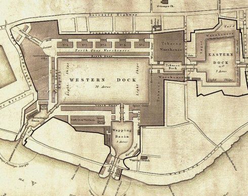
In its heyday the busy London docks specialised in luxury commodities such as silk, spices and tobacco. Now it’s a tranquil residential area with avenues of trees and a canal; more Amsterdam than London. The London Dock Company was formed in 1800 and work began the following year in building the docks. The docks were constructed by hand and required hundreds of labourers mainly economic migrants from Ireland.
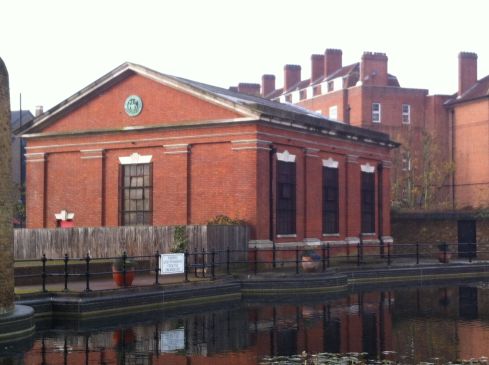
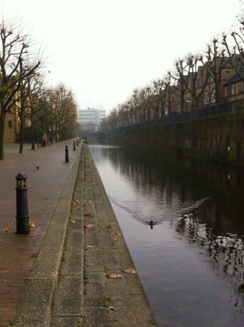
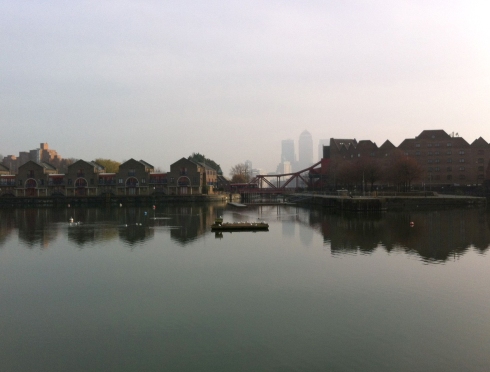
There were three connecting docks the Western, the Eastern and the smaller Tobacco. They were linked to the Thames at the Hermitage Basin and this was the starting point of my walk through the Shadwell Basin. The London Dock closed in 1969 and the land was sold to the London Borough of Tower Hamlets who filled in the dock with the intention of building houses. Connecting canals between the docks remain plus a strip of water on one side of the Western dock providing a footprint of the original docks. Information boards along the route have the original byelaws which include rules for the Master of Vessels. Water fowl are the only things now navigating the waterway.
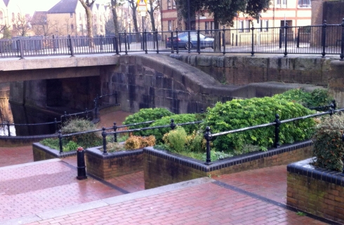
Locks have been transformed into decorative ascending flower beds and water level markers are still visible in the stone lining of the canals. As you approach the smaller Tobacco dock two replica ships are visible,in dry docks, close to the warehouse.
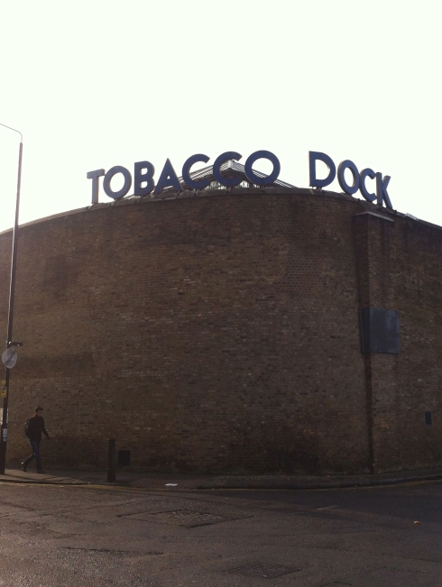
Tobacco Dock is a Grade 1 listed building (1812) and in 1989 was converted into a shopping mall at a cost of £47 million. The development included high end shops and restaurants with a terrace overlooking the canal. Retail and recession are not happy bedfellows and by the early 1990s the shoppers stopped coming and the shops began to close. Except for the occasional private events its been closed for business ever since.
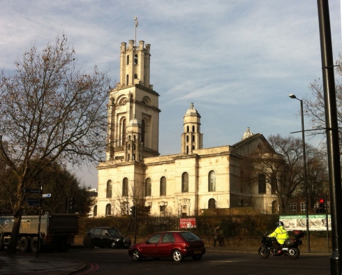
Opposite the warehouse is the majestic Hawksmoor church St George in the East. This was severely damaged by bombing in 1941 which meant that services were conducted from a prefab in the grounds which became known as St George in the Ruins. Within the shell of the church is a re-designed place of worship built in the 1960s.
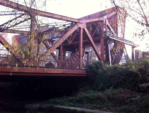
Much of the Eastern dock is now a parkland with the inevitable new waterside luxury apartments rising on the canal banks. The striking structure of the bascule (swing) bridge leads the way into the Shadwell Basin with Canary Wharf on the horizon.
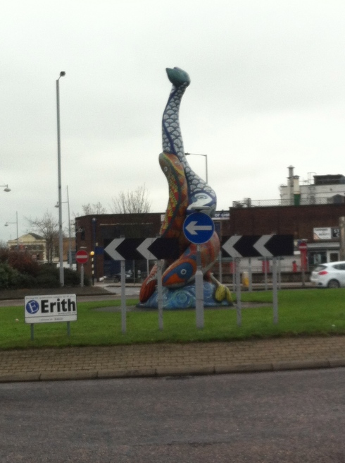
Erith can boast a couple of things. It once had the longest pier along the Thames, it’s the town where Margaret met Denis (Thatcher of course) and its probably got the naffest piece of public art to celebrate its maritime past. It’s an unlovely place but that’s no surprise considering it was so badly bombed in the Second World War. Redevelopment of the town centre has left little of architectural interest apart from the two churches Christ Church and St John the Baptist.
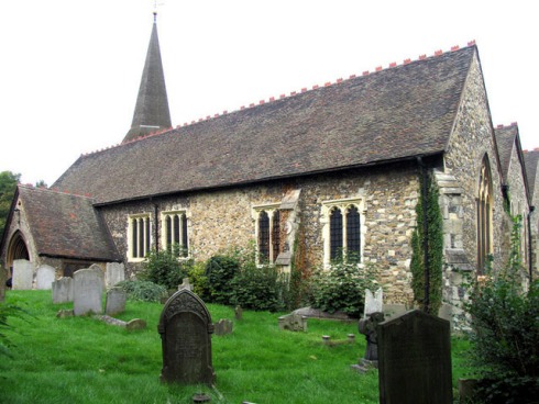
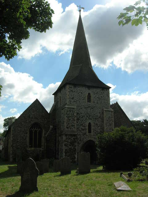
St John the Baptist Church dates back to Norman times. It is now like an island isolated within a busy road system. Entrance is still through the Lych Gate and the turquiose, brick red and dark grey Victorian flooring tiles reflect that it was expanded in the C19th century. The inscriptions of the ancient gravestones are barely visible obscured by lichen or ivy. Some are still erect but many are at a precarious angle or have completely fallen and are like paving stones.
One inscription that was still clear is that of Sydney Robert Lush aged 15 and the stone was erected by his work mates from the Maxim Norde Felt Gun Company. This and the Callender Cable Company were the two main industries. Many of the streets in the area take their names from these industries, such as Maxim Street and Maximfeldt Road.
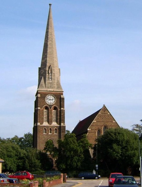
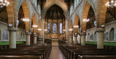
Christ Church in the centre of the town is Victorian Gothic but of a medieval scale. In the Victorian period it would have been a significant feature on the river landscape. It was built in 1874 to a design of J. P. St Aubyn a prolific church architect.
The town enjoyed a brief period of fame as a place to visit when it built some pleasure gardens in 1842. Now, it has Ocean Park on the river front which is small and uninspiring. The Green Chain will take you out of the town through Franks Park. Named after a local businessman Frank Beadle. The information board is idiosyncratic as it tells you where things used to be like the former bandstand and air raid shelter. There are no actual markers of these landmarks in the park. In the centre of the park is a well equipped play area that has a wide horizon view of the river. This is a view of a working river.
If you travel on The Ernest Bevin Ferry go down to the passenger lounge you can see a “Precious Place” plaque. It has an inscription,
“The ferry has been a constant in my life – the one thing that hasn’t changed around here since I was a boy”.
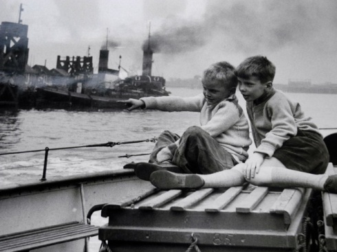
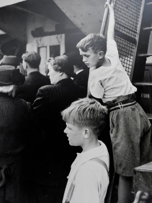
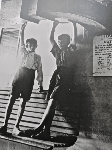
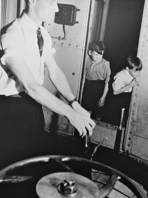
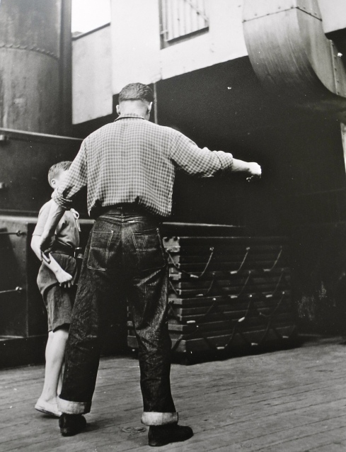
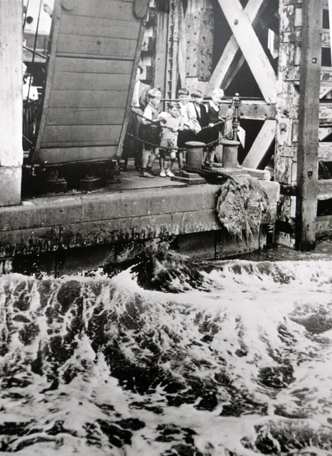
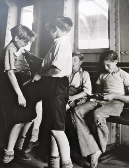
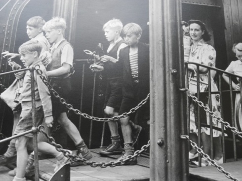
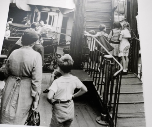
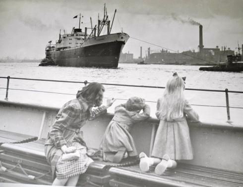
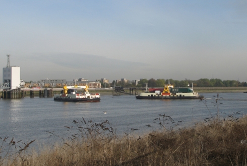
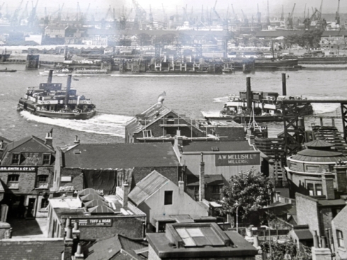
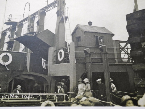
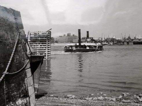
A reminder that the ferry has fond memories for many local people. I have since found some photographs of Richard Branker and Kenneth Cooper who in 1961 spent a summer holiday riding the Woolwich Ferry. They were aged 7 and 9. Oh, how things have changed; then the world seemed a safer place for children. The boys lived within a few hundred yards of the ferry and managed to have fun riding it, and of course it was free. They were not the only ones taking advantage of the free ferry as these photos show.
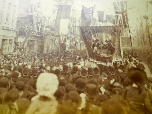
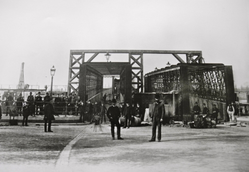
It’s hard now to imagine the joy of the people of Charlton, Plumstead and Woolwich when the Woolwich Free Ferry opened 23rd March 1889. Contemporary accounts describe the thousands of people who flocked to Woolwich for the opening ceremony and festivities. The headline in the Kentish Independent was:
Magnificent Day at Woolwich – a day never to be forgotten.
Yet, 130 years on from when the Metropolitan Board obtained Parliamentary Powers to establish the Free Ferry (1884); the future of it is uncertain. The TFL River Action Plan confirms that it has the greatest volume of passengers than all the other means of river transport yet in its consultation on River Crossings it is proposing to re-site it to Gallions Reach with no assurances that it will remain free.
In the C19th the people of Woolwich, Plumstead and Charlton campaigned for over ten years for a free ferry as a necessity for this part of East London. The crossings from Lambeth, Waterloo and upstream as far as Staines were all free. The people in East London were taxed heavily in order to subsidise the western gentry who crossed the bridges, from the city upstream, untolled. Transport in South East London was by ancient wherries and the railway steamers. On 18th October 1880 a Public Meeting in Woolwich Town Hall passed a resolution for the development of a Free Ferry.
The development of the ferry was not without setbacks. Disaster struck 11th March 1889 when a fire broke out on the South Pier. A tar barrel accidentally overturned. The fire brigade from Shooters Hill were called but they would take at least 20 minutes to get to the pier. The heroes of the day were the Warspite Boys who spotted the smoke and used their initiative to take the Marine Society’s launch,which had a fire engine on board, from Charlton to help. The Warspite was a training ship for orphaned boys that was originally kept on the Thames by Warspite Road.
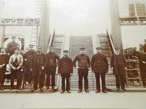
On the opening day the Warspite Boys lined the road to the pier and were given a half-a-crown (twelve and a half pence) for their support in putting out the fire. Workers from the Royal Arsenal and Royal Woolwich Dockyards were granted an hour off work to attend the opening ceremony. Two hundred police, 30 mounted, lined the streets when Lord Roseberry, first Chairman of the London County Council, arrived to open the ferry. The barometer was high, there was a gentle breeze from the West and Hare Street was beautified. Venetian masts of crimson cloth and ornamental crowns decorated the streets. Five hundred masts were erected to fly 20,000 banners and flags.
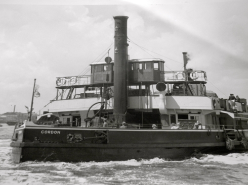
Captain Young set sail from the North Pier and Captain Giles from the South to a salute of guns from North Woolwich. The two ferries were Gordon and Duncan and the journey across the river took three and a half minutes.
On that day over 25,000 persons travelled on the ferry. There was an official banquet for 200 people and street parties for the townspeople. The revelry went on through the night. The Kentish Independent describes the day as:
“A day the like of which few localities have upon their records.”
TFL are planning a further consultation on the future of Woolwich Free Ferry in 2014.
There was a time when the well off moved away from the river unlike now when a riverside apartment is de rigueur. Back in the C19th Shooters Hill was the place for the factory owners, shipbuilders and landed gentry to build their mansions. It’s one of the highest points( 129 metres) in London and has magnificent views over to the city.
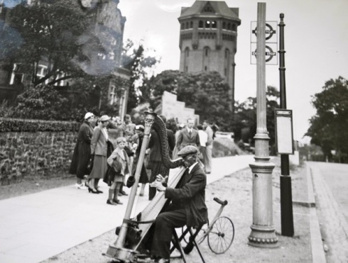
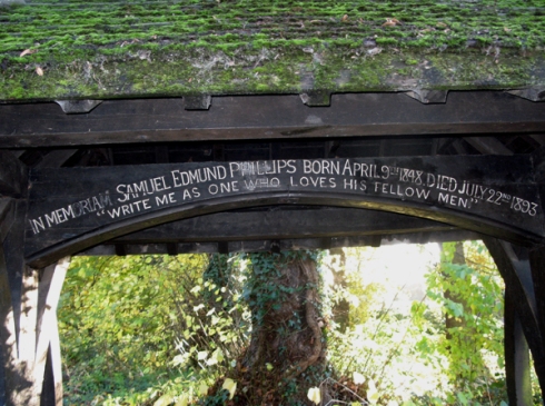
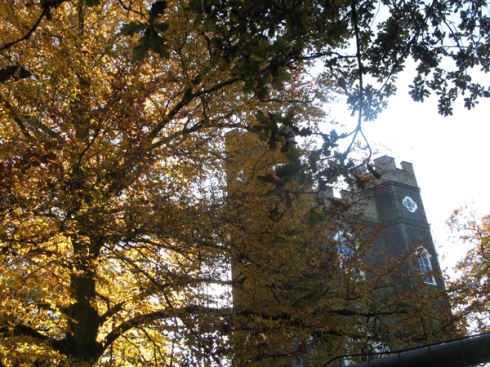
Sitting on the crest of the hill is a Victorian Gothic water tower which dominates the landscape. Opposite is the entrance to Oxleas woods: an ancient woodland thought to be one of the most important areas for wildlife in the whole of London. This wooded area dates back thousands of years so, its no surprise to know that it was a favourite haunt of highwaymen. Before entering the woods there is a wooden covered seat which looks like it has become detached from Christ Church but it is in fact a memorial to Samuel Edmund Philips (1848-1893) who had a large electrical cable factory on the Thames at Charlton. Hidden amongst the tall oak trees is an underground reservoir, the remains of Castle Wood House and Severndroog Castle.
Severndroog Castle is in fact a folly built by Lady James to commemorate her husband, Sir William James’ conquest of Severn Droog on the coast of Malabar 2nd April 1755. Now managed by the Severndroog Trust it is in the process of a complete restoration.
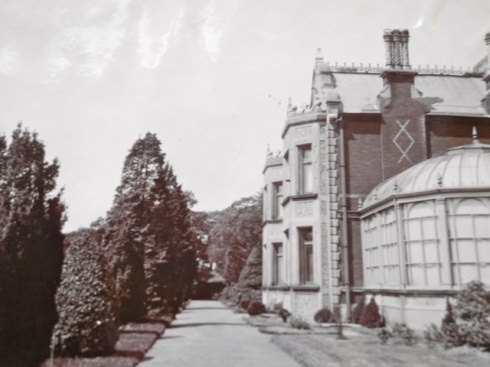
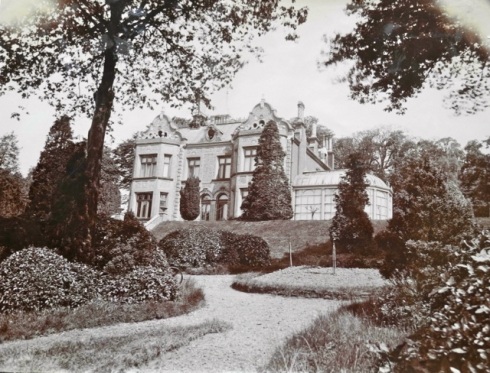
In the C17th this land belonged to Sir John Morden, who also built The College named after him in Blackheath. In 1869 Mr Barlow a ship owner leased the land and built Castle Wood House. It was demolished in 1922 a period when the gentry were on their uppers and struggling to keep their big piles going. Its shadow can still be seen in the landscape.
The walk through the woods is interrupted by open spaces. Look closely and you can see that they were once the gardens of Castle Wood House and they become more formal and symmetrical as you ascend. The terraces and stairs remain and from the top of these are spectacular views of London. Pieces of the original architecture provide interest with hidden arches and lichen encrusted walls.
The underground reservoir is quite difficult to find. It’s in the area known as Oxleas Meadow.
Refreshments are available in the Oxleas Wood Cafe or The Bull. This ancient inn dates back to 1749 and was once a manor house and religious services were held there before Christ Church was built in 1854. Thankfully, it’s still a traditional boozer.
Guest Post by BK
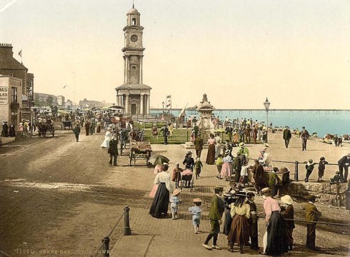
Just like Ancient Rome, Herne Bay was created by two young men. As a founding myth put it:
‘Early in 1830 two capitalists drove to Herne Bay for a ride. They were struck with the unwrought condition and the deathlike inactivity of everywhere around them and on the other hand with the capabilities presenting themselves at every step. Here might a town, full and complete, be raised.’
One of these men was George Burge an engineer who had worked with Thomas Telford. He had visited Southend,on the other side of the Thames Estuary, and been impressed by the prosperity that its new pier had brought to the town. Attracting a stream of visitors travelling down from London on steam boats. He was looking for a similar site on the Kent side. Herne Bay seemed ideal because it had a low-lying coast line and was close to London via the Thames and not marshland, occupied by industry or the military.
Herne Bay was ideal because, as quoted above, there was very little there. In fact there wasn’t even a Herne Bay. The coastal area was an outpost of the inland village of Herne and had just had a few cottages where fishing and smuggling were the main industries.
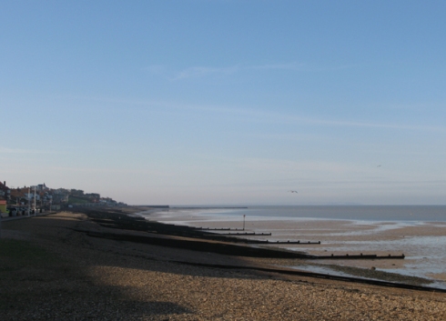
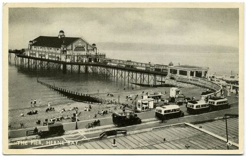
Burge and local entrepreneur Sir Henry Oxendon began buying up all the local land and planning what could be described as Britain’s first specially created seaside resort which they called Herne Bay; although if you look at the coastline, there is not really much sign of any bay. Burge and his assistant Thomas Rhodes set about building the pier which was central to their plans. Unfortunately, Rhodes was a carpenter and so built the ¾ mile long pier out of wood.
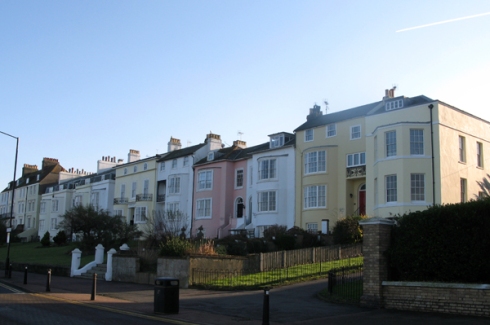
By 1835 everything seemed to be going to plan: 30,000 visitors disembarked at the pier. Three hotels, grand houses, baths, assembly and billiard rooms had been constructed. Herne Bay had :
‘Accomodations equal to the best houses in town, or those of the most fashionable resort. First rate cookery, excellent wines, elegant apartments and the charges fair.’
However, a darker side was also beginning to emerge. In 1834, 28 people were reported to have died in an outbreak of cholera. Local reports were quickly suppressed. Two local surgeons wrote to The Kentish Gazette.
‘Sir. Alarming, malicious and false reports have been circulating relative to the ravages of cholera in Herne Bay. We beg leave to inform you that there is no such disease at present existing in this place and that the neighbourhood is now in its usual healthy state.’
However, the rumours did not go away and in 1835 a visitor reported.
‘Herne Bay and The Ague are now synonymous terms. The town, if it may be so called, lays very low, hence its tendency to produce ague. For children it is very unhealthy.
Ague was a type of mosquito-borne malaria. The report refers to the fact the Plenty Brook which runs through the town was very sluggish and so prone to harbour insects. A result of the low coastal strip that had attracted Burge in the first place.
The authorities tried to brush off this bad publicity and in 1837 the town had its first royal visitor, The Duke Of Cambridge, who disembarked and took tea at the Pier Hotel. After the visit it became known as The Royal Pier Hotel until it was demolished in 1968.
Herne Bay maintained its popularity despite the health scares and in 1842 41,000 people arrived at the pier. What “did for” Herne Bay was the arrival, or non-arrival, of the railways.
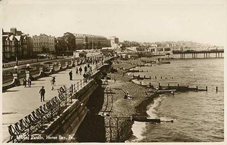
Before 1840 the only way for an ordinary Londoner to enjoy the healthy air of the seaside was to take the steam boat to one of the resorts on the Thames Estuary in Kent or Essex. It was impossible to visit the English Channel beaches in any reasonable time. The railways changed all that. Brighton opened a station in 1841, St Leonard’s in 1845, Eastbourne in 1849. All along the South Coast there was a huge growth in tourism and of local populations. However, anybody wanting to take the train to Herne Bay had to change at Canterbury and then get on a horse-drawn tram along the muddy road to their destination.
The change in leisure fashions hit Herne Bay hard. A 1850’s report mentioned ‘long lines of streets, many still unfinished, stretching out in every direction’. The problems caused by the low-lying river continued and further outbreaks of cholera and fever were reported. A report by the local Guardians stated that the drains and dwellings were in a filthy condition and that pig styes and dung heaps were a perpetual nuisance. Not what you want in a holiday destination.
The Pier, being made from wood, gradually rotted away and was declared unsafe in 1862. Steam boat traffic stopped. Some relief was provided when a railway branch line from Faversham opened 1861, but a direct line from London was not available until 1863. The line then ran on to Margate which had similar troubles.
Herne Bay never recovered its premier seaside status but soldiered on as a sort of second division resort; but unfortunately it never stopped being a figure of fun. The Leisure Hour’ magazine said:
‘It is coachless, cabless, busless, horseless, assless, and with the exception of an isolated, invalided poodle, dogless.’
And The Illustrated London News:
‘Herne Bay is not popular. It’s founders attempted too much and failed. Ridicule has done its utmost to deter people from visiting it.’


