You are currently browsing the tag archive for the ‘Kidbrooke’ tag.
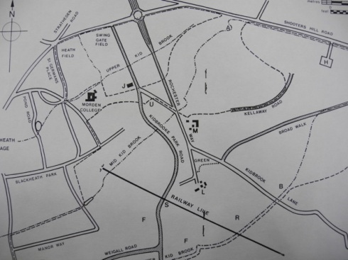
It wouldn’t take a genius to guess that Kidbrooke takes its name from a stream but, like me, you may be surprised to learn that there are three brooks all called Kid – Lower, Upper, and Mid. Although looking at the street names on the Brook Estate should have been a clue that there is more than one stream. Today, the streams are mainly underground in culverts and only surface here and there.
The streams flow in a south westerly direction and are tributaries of the River Quaggy which in turn flows into the Thames. The Quaggy had been buried for over 50 years under Sutcliffe Park, so most people living in the area didn’t know it existed. It,like the Kid Brooks, was erased from the collective community memory. These streams and rivers have since been called lost urban rivers. In 2003 the Quaggy was daylighted which is the term used to describe the restoration of river. Allowing the river to assume its natural state helps to reduce the risk of flooding in built up areas as well as providing a wetland habitat for wildilfe. It has also enabled some of the new development at Kidbrooke Village to be marketed as having a river view.
This marshy land was home to some of the last farming communities in South East London. There were four farms: Kidbrooke, Upper Kidbrooke, Lower Kidbrooke and Kidbrooke Hill. The Express Dairy stopped farming here in 1937 and the land developed for housing, industry and the military.
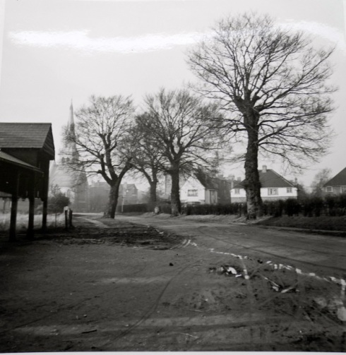
The old photographs of the area show clearly the land was prone to flooding. When the Royal Herbert Hospital was being built in the mid C19th, on what was Kidbrooke Common, builders battled with flooding and subsidence. By 1881 serious subsidence was evident in the chancel of St James’ Church in Kidbrooke Park Road and it had to be rebuilt.
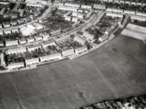
The 1970 aerial photograph shows the corridor of green, now sports fields, that follows the path of the Lower Kid Brook. One of the fields belongs to The Samuel Montagu Youth Centre, named after the City of London Banking business of the same name. One of the world’s strangest sports, Chessboxing, started here in the 1970s by brothers James and Stewart Robinson. It’s now an international, fast growing sport that combines a round of boxing followed by a game of chess.


